Great Yarmouth occupies an important and unique place in the history of warfare in the British Isles, being one of the targets of the first air raid on Britain carried out by a German Zeppelin on 19 January 1915. In an ironic twist, on 5 August 1918 the last German Zeppelin air raid targeting Britain during the First World War was shot down by an aircraft based at Royal Naval Air Station South Denes just south of the town.[1]
Whilst Great Yarmouth did not occupy anywhere near such a prominent position in the German bombing campaign against Britain during the Second World War, the town was repeatedly targeted between July 1940 and June 1944 with a total of 221 ‘incidents’ recorded in the town’s ‘Summary of Bombs and Casualties’.[2]
The Bomb Map
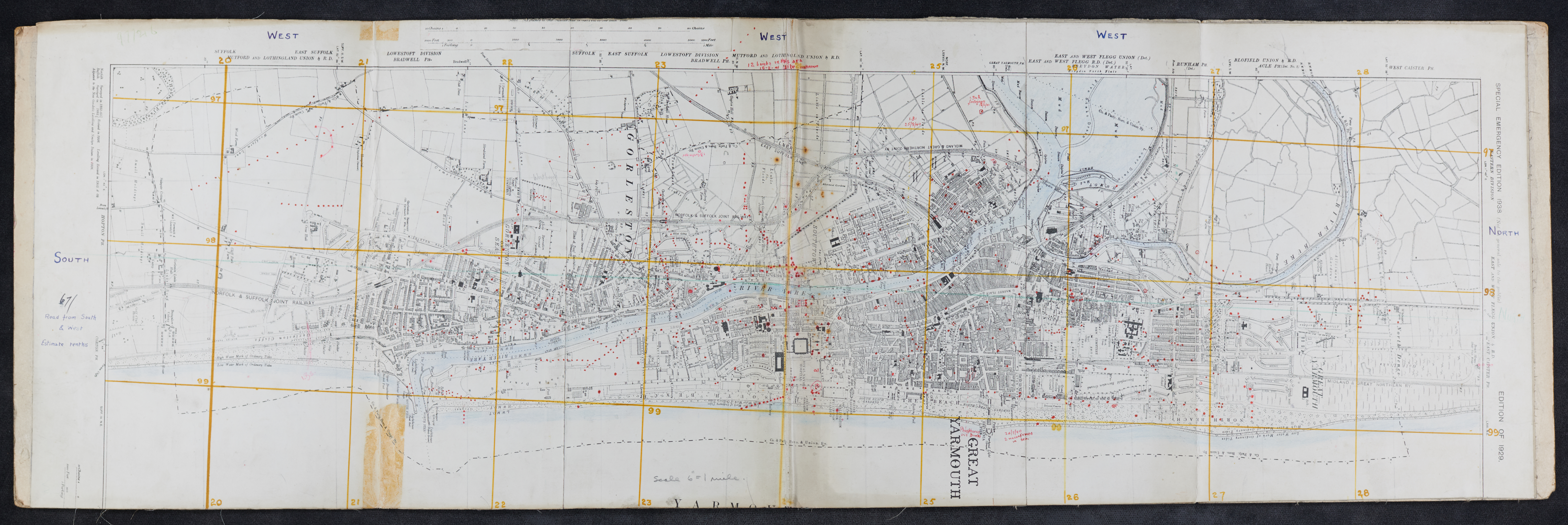
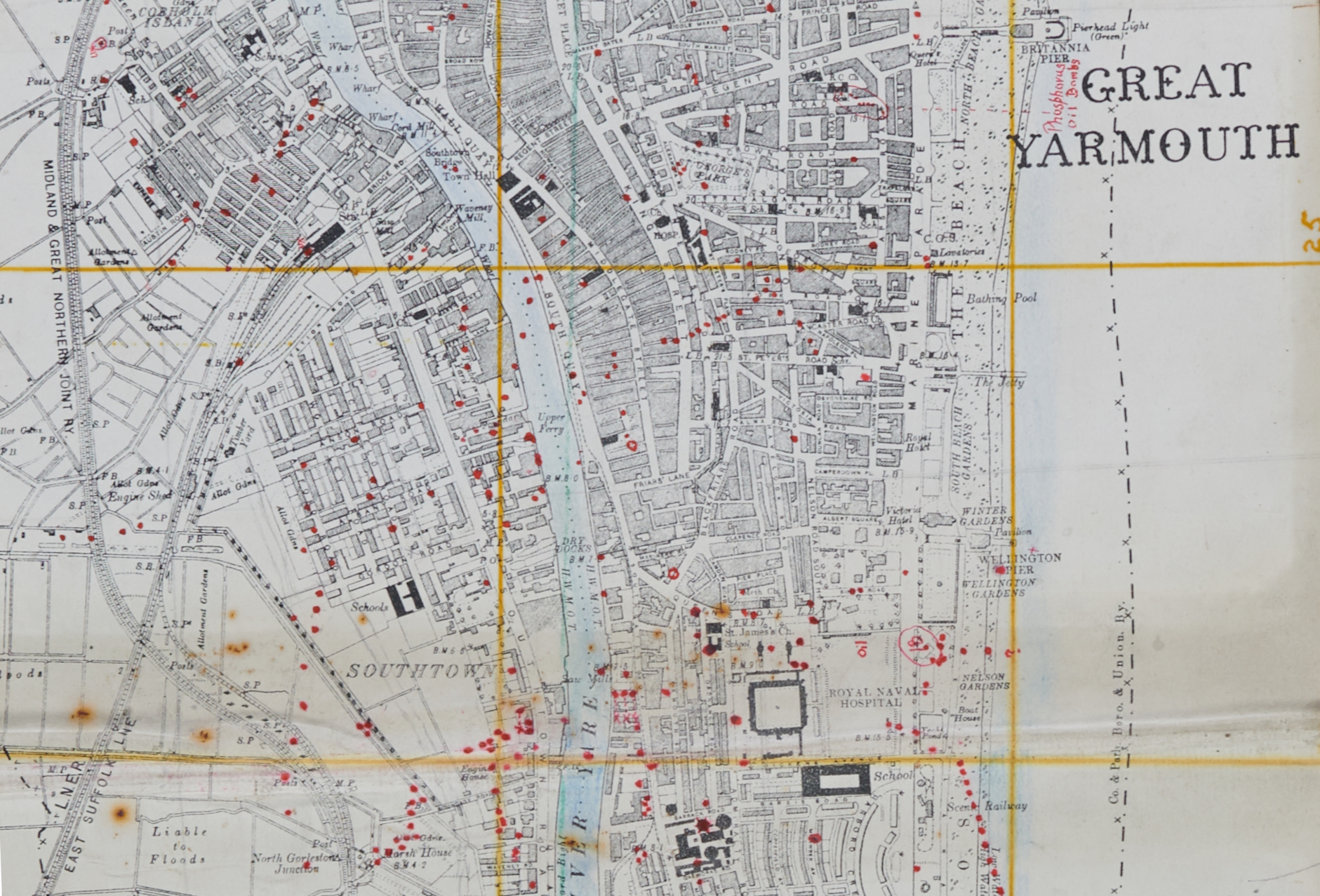
The bombs dropped on the Borough of Great Yarmouth were recorded on a ‘Bomb Map’, a ‘Special Emergence Edition’ of a standard six-inch to the mile Ordinance Survey map with small red dots marked on the map representing where each individual bomb fell.
Read more: Mapping and recording the bombing of Great Yarmouth during the Second World WarThe map itself is a somewhat improvised creation being simply an Ordinance Survey map stuck onto a large piece of cardboard which has instructions for gas decontamination procedures on the back of it. It was one of many such maps created by local authorities as part of the ‘bomb census’, a project by the government to document the entirety of the German bombing campaign against Britain. The location where each bomb fell is marked by a simple red dot. These dots are usually clustered together in long straight lines representing ‘sticks’ of bombs, a series of bombs which were all dropped from the same aircraft and which landed at regular intervals.[3]
A Summary of the Bombings
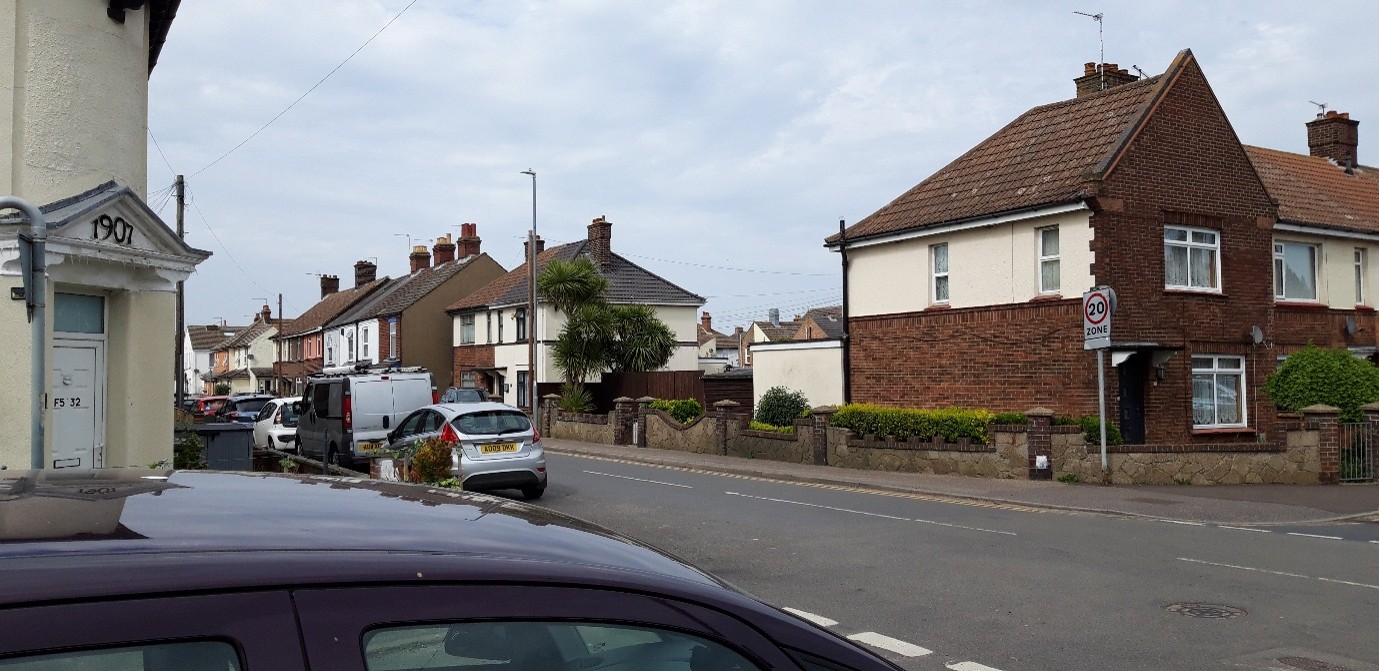
The first bombs fell on the Borough on 11 July 1940, although the first ‘war damage to properties’ that was recorded was an explosion midway along Britannia Pier as part of ‘Local Military Precautionary Measures’ to hamper any potential German landings. Seven high explosive bombs feel near the intersection of Gordon and Stafford Roads killing four people and injuring a further three more. Over roughly four years a total of 9,918 bombs were dropped on the borough, with 1,077 of these being high explosive bombs, 8,832 incendiary bombs and 9 parachute mines. These bombs killed a total of 216 people, 96 men and 120 women, and injured a further 581 people.[4]
This death toll is comparatively mild in the context of Second World War bombing campaigns with there being 131 recorded incidents in which nobody was killed or injured and 46 incidents which resulted in only injuries.
1941 was the most concentrated year of bombing which the town experienced during the Second World War with just over three quarters of the incidents and just under half of the deaths caused by the bombing raids happening in that year alone. The later fact is especially significant given the fact that nearly a quarter of the total number of deaths were the result of a single raid in 1943. However, the intensity of the bombing still varied throughout the year with there being only three raids in January and September of that year and no raids at all in December. By far the most intense period of the bombing campaign was the April to July of 1941. In this four-month period just slightly less than half of the total number of ‘incidents’ that the town endured occurred. Additionally, roughly half the total amount of high explosive bombs that fell on the town did so in this period.[5]
Notable Incidents
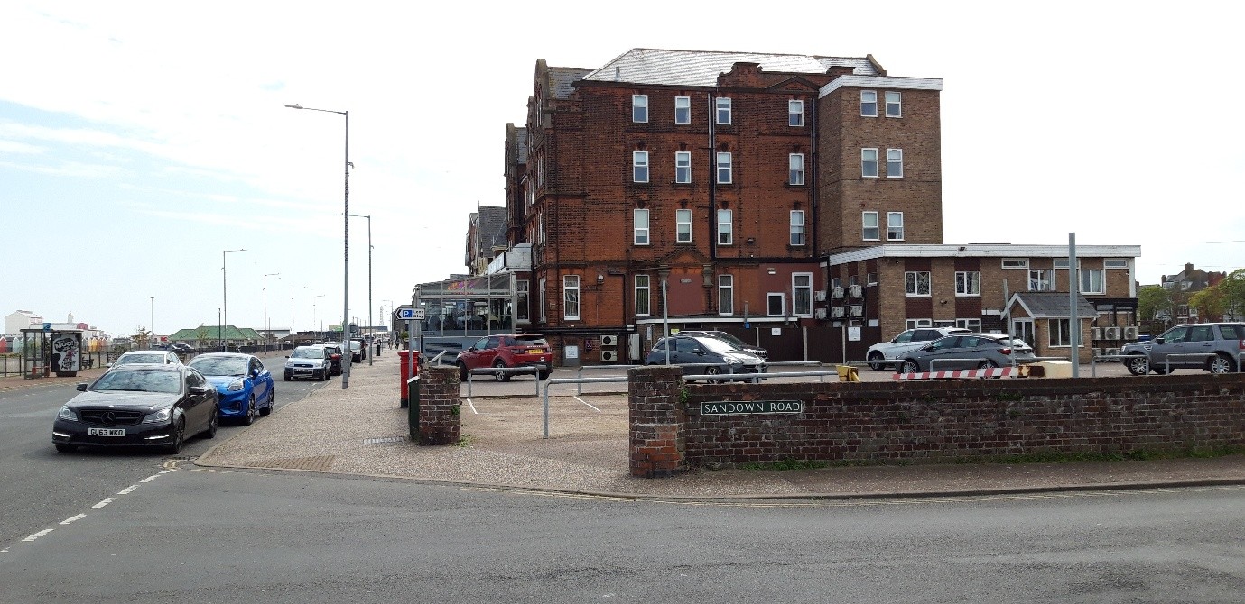
The deadliest raid on the town, by a substantial margin, was also one of the last that it endured. On 11 May 1943 14 500kg high explosive bombs were dropped over a wide area of the town from Hawkins Avenue to Sandown Road on the sea front. This caused the deaths of 50 people, 26 of which were women of the Auxiliary Territorial Service. A further 40 people were injured.[6] This represents over a quarter of the total deaths from bombing that the town suffered during the whole war.
Almost half of the total number of incendiary bombs that fell on the town did so in a single night. On the night of 7-8 April 1941 approximately 4,000 incendiary bombs fell over such a wide area that in the ‘Summary of Air Raid Incidents’ the location is simply recorded as being the ‘whole of [the] Borough’. Despite this massive blanketing of bombs across a significant proportion of the town only 17 people were killed whilst a further 72 were injured.[7]
Building on Bomb Sites
The bomb map also reveals the extent to which Great Yarmouth and Gorleston have expanded since the Second World War. During the war many of the bombs fell in open fields, doing little more than subjecting a few areas of farmland to some rather violent and unexpected ploughing. This can be seen through the fact that at least 50 incidents have asterisks next to them in the summary of bombs and casualties indicating that ‘no damage’ was caused as a result of them. There are also many examples of bombs falling in what were at the time open fields but are now residential neighbourhoods and industrial estates.
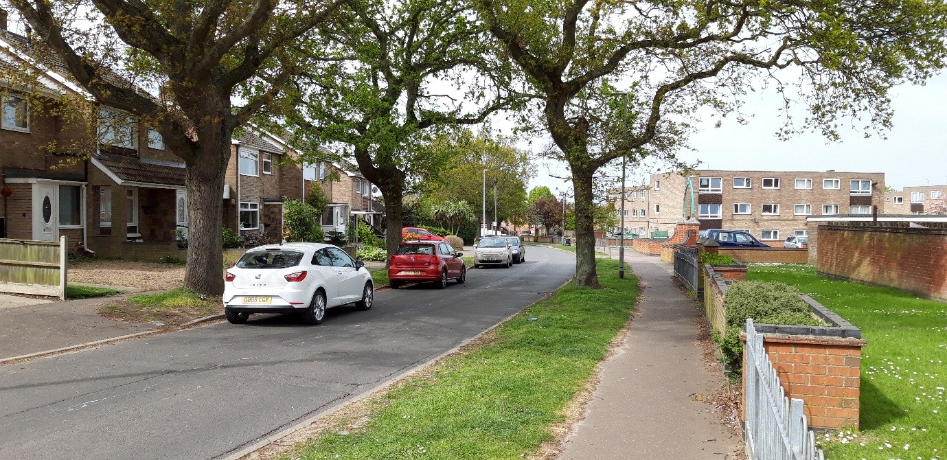
For example, on 12 May 1941 a stick of 14 bombs fell just North of Gorleston Old Cemetery in what was then a series of allotment gardens but which now follows almost exactly the path of Oak Road.[8]
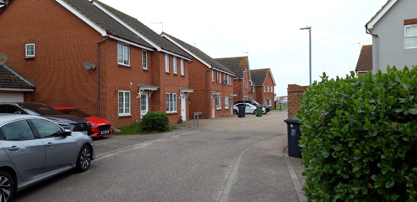
Similarly, on 24 June 1941 22 high explosive bombs fell in a long stick across what was at the time empty farmland just to the east of Woodfarm Lane but which now includes Ormiston Herman Academy and a housing estate immediately south of the James Paget Hospital.[9]
Researched and written by Harry Raven
Primary Sources
Casualty returns, 1941-3. NRO, Y/CD 101.
Record of bombs dropped and fatalities, with press cuttings of Yarmouth names on the roll of civilian dead. NRO, Y/CD 103.
List of incidents in which property was damaged, with summary of bombs and casualties. NRO, Y/CD 104.
Map showing where sticks of bombs fell within the Borough. NRO, Y/CD 106.
Secondary Sources
Fegan, Thomas. The ‘Baby Killers’: German Air Raids on Britain in the First World War. Barnsley: Leo Cooper, 2002.
Tooke, Colin and Scarles, David. Great Yarmouth at War. Norwich: Poppyland Publishing, 1989.
Footnotes
[1] Thomas Fegan, The ‘Baby Killers’: German Air Raids on Britain in the First World War (Barnsley: Leo Cooper, 2002), 18-20, 153.
[2] List of incidents in which property was damaged, with summary of bombs and casualties. NRO, Y/CD 104.
[3] Map showing where sticks of bombs fell within the Borough. NRO, Y/CD 106.
[4] List of incidents in which property was damaged, with summary of bombs and casualties. NRO, Y/CD 104.
[5] Ibid.
[6] Casualty returns, 1941-3 NRO, Y/CD 101. and Tooke, Colin and Scarles, David, Great Yarmouth at War (Norwich: Poppyland Publishing, 1989), p63.
[7] Record of bombs dropped and fatalities, with press cuttings of Yarmouth names on the roll of civilian dead. NRO, Y/CD 103.
[8] List of incidents in which property was damaged, with summary of bombs and casualties. NRO, Y/CD 104.
[9] Ibid.