
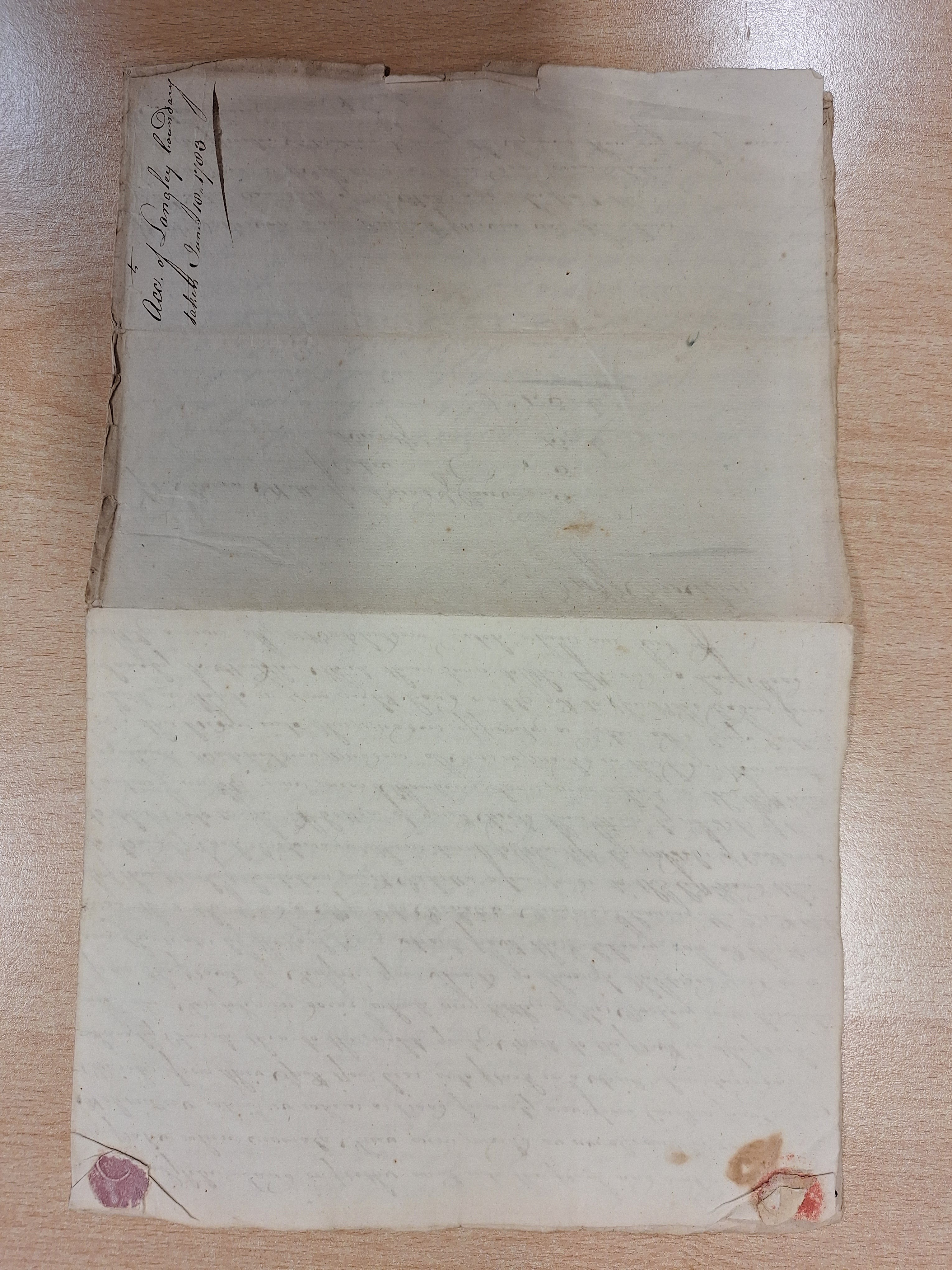
The bundle of documents from the Norfolk Record Office, about the parish boundary at Langley, near The Broads and below the River Yare in Norfolk, contains two transcribed and original manuscripts from 1738 and 1783 respectively. They suggest a theme. The 1738 document is a particular of a valuation of Sir Richard Berney’s estate. The Berney family had recently squandered some of their inheritance and got into debt. The marriage of Sir Richard’s next in line meant selling off the newly built Langley Hall and transferring lands and awards to their new owner. This document denotes an economic history which goes back to the early fifteenth century when the Berneys acquired the decommissioned abbey lands. Next, the Perambulation of Langley Parish, undertaken by a group of about thirty people on Wednesday 18th June 1783. Antiquarians writing about the descent of the manor failed to bring to life the social memory or the day to day lives of their indigenous communities. Today, approaching the old abbey by following the signs off the busy A 146, the gated parklands quicky give way to rolling arable land and flat pasture, marshes and signage to the Broads National Park. Away from the park, one can just imagine a group walking the bounds: intent on identifying the marks on a pollarded oak, for example; or, going up a causeway from ‘Langley Street towards Cantley’; the “new” marsh wall, as walked upon; Hardley parish on one side, Langley the other; a boat being taken across a particular dyke. These examples are extracts from The Perambulation of Langley Parish boundaries, when, rich and poor alike, they walked the bounds of their parish: sometimes dividing up with one lot taking to a boat, but all times leaving the actual river aside.
Read more: A Perambulation of Langley Parish: Wednesday June 18th, 1783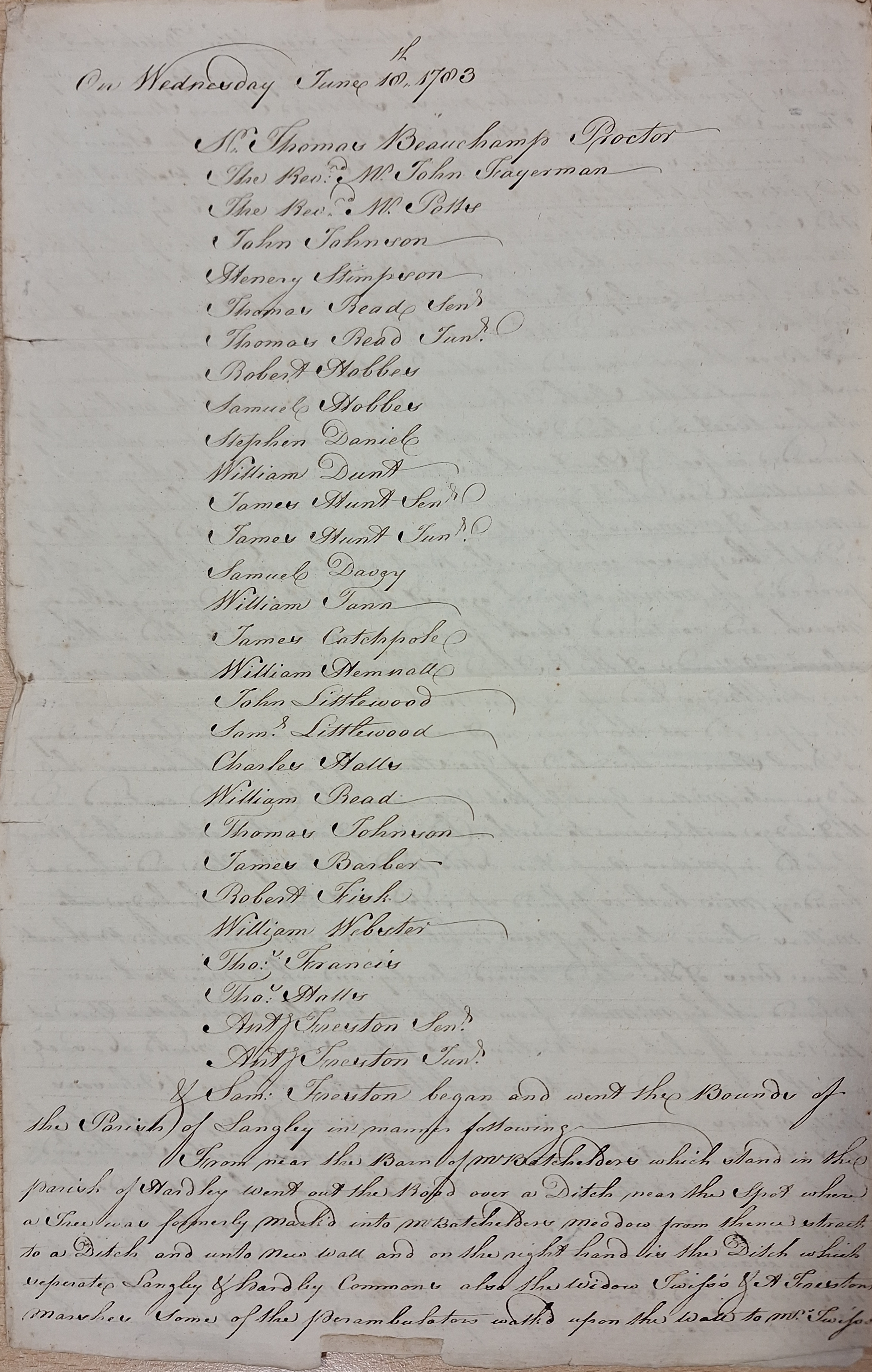
The NRO holds Commissioners of Sewers maps from around 1770 for a long stretch of the River Yare. Indicated therein is the specific dyke which separated the parishes, at either end of the Langley stretch, measured in yards. Qualitatively by referencing such minute details, such as a tree marked in a corner of Carleton Road gate, or a tree said to be marked but dead or not found (in the Abbey Bottom Warren hedge): from the Perambulation one can begin to trace the actual boundary oneself by layering over sections of many of the maps and documents outlined. In the account, the palings of the newly built parkland are encountered as a neat way across the park. Some field names appear dialectal, and it is an exercise in local history to try and follow these in historical maps. Writing in D. Heys, The Oxford Companion to Family and Local History, worthy fens historian Joan Thirsk noted that, “The relationship of economic history with social history, and its potential for advancing local history… survived in M. F. Davies, Life in an English Village (1909), describing Corsley, Wiltshire. It examined one village from multiple viewpoints… tracing parish boundaries, dwelling on the significance of the Hundred Oak Tree as a meeting place and locating it physically”.
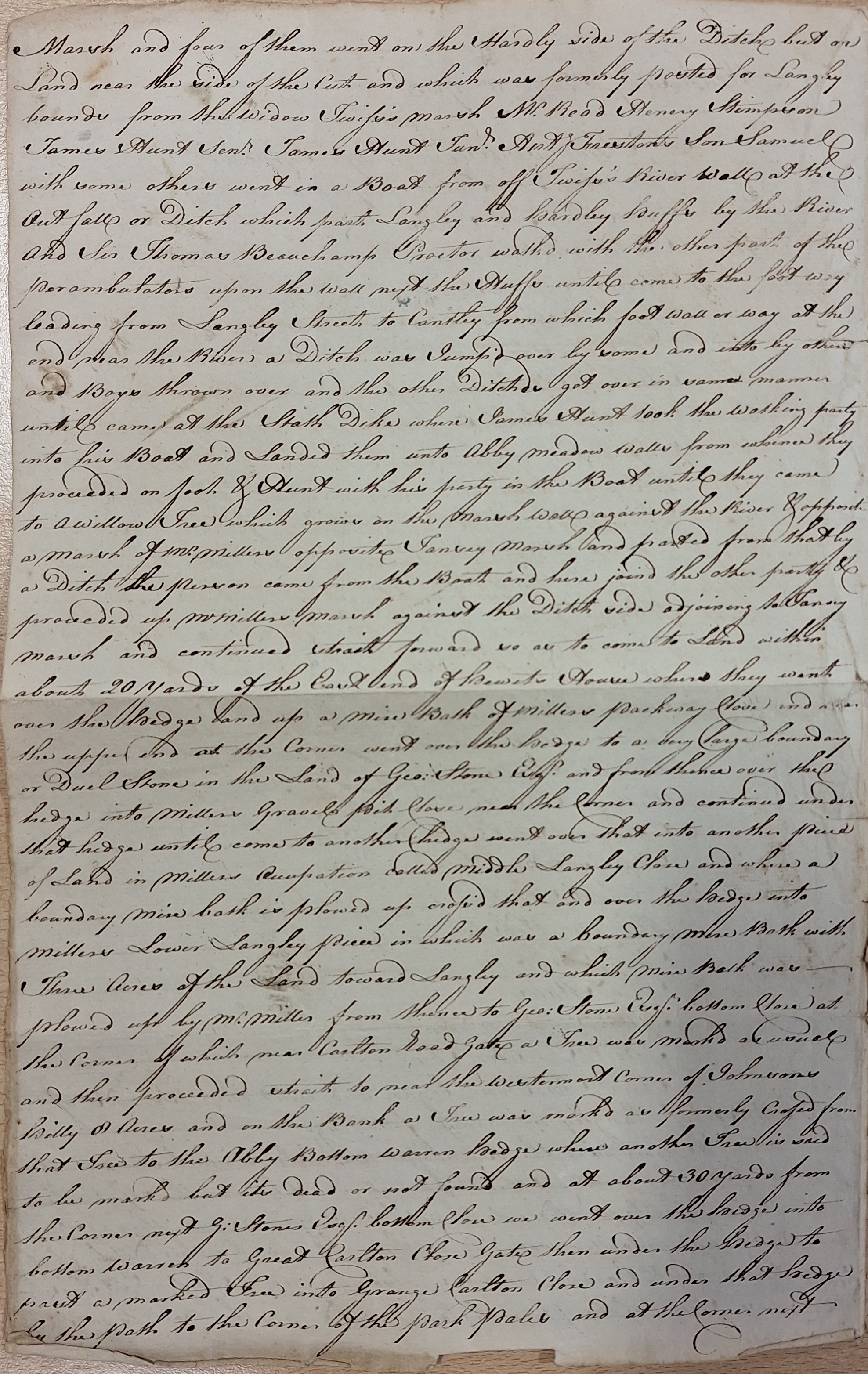
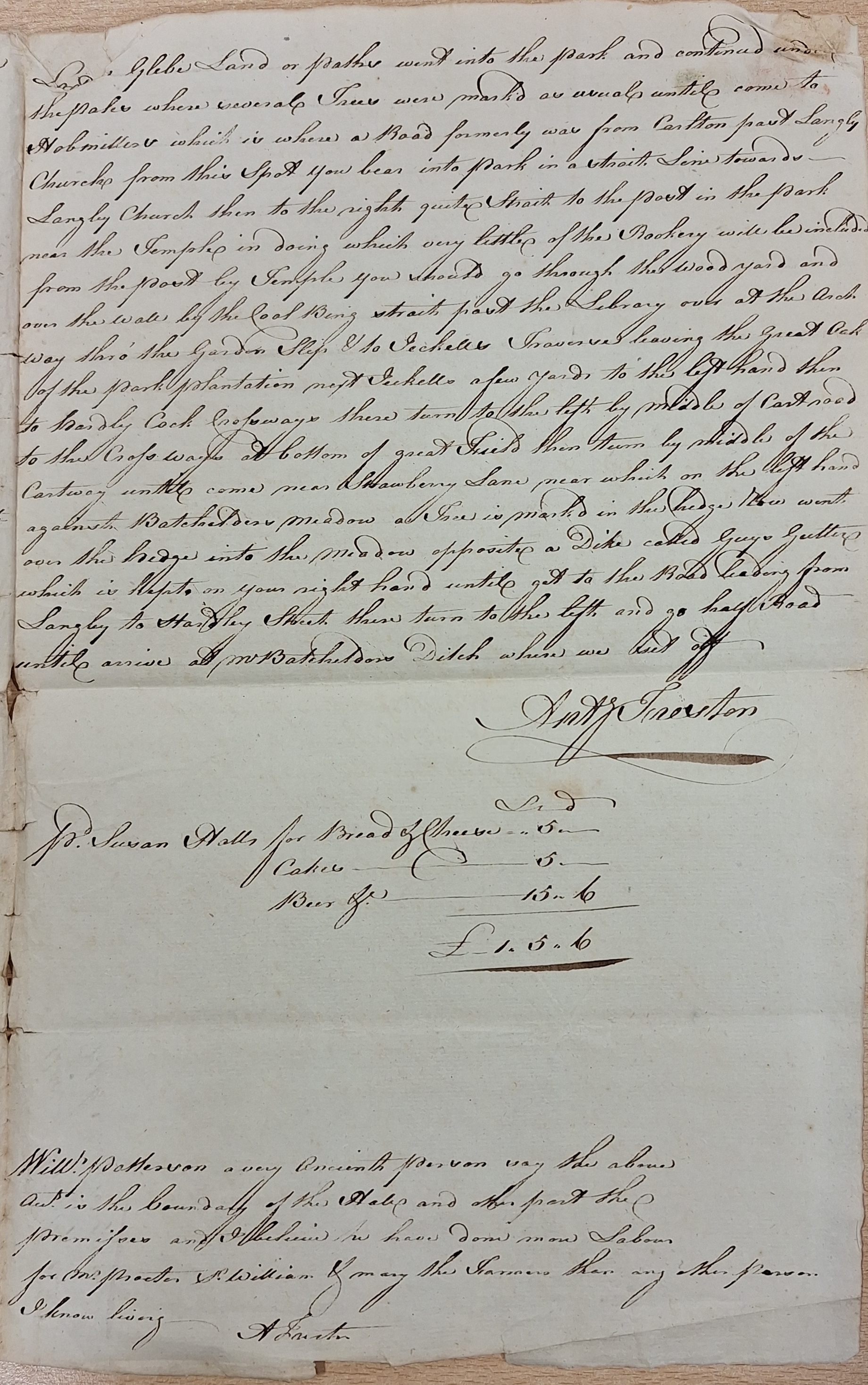
Perambulations were not common after the seventeenth century, and the reason for this account surviving in the records appears to be a little obscure. Parish perambulations once happened in Rogation week, between April 25th and Ascension Thursday. Feasts to mark this week were traditionally enjoyed even into the eighteenth-century, . The Rogationtide perambulation customarily included donations of loaves, cheese, malt, and hops to provide “drinkings” along the way. In the Perambulation of Langley Parish, the bread and cheese, beer and cakes were acquired from Susan Halls for £1 – 5s – 6d. But regionally widespread customs that survived the Reformation were hard to keep up. More likely then, given the new landowner’s preoccupations as a diplomat abroad, it was still important for ordinary people living there to continue to define the parish territory bounds. On reading this account we can see that it was possible to do (because there were not man-made barriers) but not easy. Also, there was an upcoming important national centenary, soon to be celebrated, of the Glorious Revolution, with the return of the king in 1688. This might have been a second motive for documenting such a quasi-customary walk, even for a hidden away parish such as Langley. Early Modern England was more participatory than democratic. Nevertheless, because its state had not yet developed the bureaucracy to provide for its local government, unpaid members at the local level were taking responsibility for day-to-day government. It could have been easy for them to opt for something more in keeping with the river, for its inhabitants eking out a living thereabouts and their long histories within the landscape. A perambulation with obstacles also resembles a pastime.
Whichever the case, the value historians gained by exploring parish boundaries predates landscape history. This account was written down by one Anthony Freston and included that, having already walked the bounds, “William Patterson a very Ancient Person say the above Acct is the boundary… and I believe”.
Tracing the route as the best parish boundary, over a historical map and georeferenced, is a good way of learning about some aspects of local history, generally, and specifically within the fifty years spanned by the two documents selected. Notably, the walk starts and ends by the ditch near the same meadow, belonging to Mr. Batchelder, proceeds along the boundary and the marsh wall between Hardley and Langley marshes. Some of the individually owned marshes are visible on the Sewage Commissioners map of the adjacent sides of the river, Anthony Freston himself owned one. Descending from a corner known as Carleton Close, it divides the park and follows a line between allotments, past Hardley Cock and Strawberry meadow and the Great Langley field. The markers and field names mentioned as significant consistently appear over markings, feint and partial, of consolidated maps and drawings, as outlined below: sewage maps, georeferenced representation of a tithe map for Langley and Hardley, enclosure award map of Hardley with part of Langley parish, and a map of Langley estate from the seventeenth century.
Researched and written by Edward Forrester



Dear EdwardsThank you for your interesting article
LikeLike